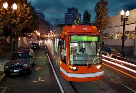
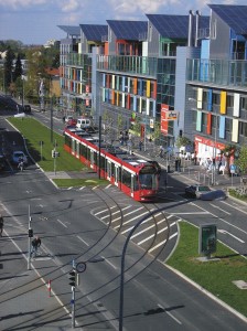
BCIT to UBC and Picnics in the Park, by Tram
First published in 2009. Updated 2014, 2016.

A Wee Bit Of Local History
In early 1996, during BC Transitai??i??s meaningless public consultation period for the Broadway Lougheed Rapid Transit Project which later morphed into the Millennium Line, Zweisystem received a phone call from an European Transit specialist, who worked for Asea Brown Boverai (later absorbed by Bombardier Inc.) regarding the project.
The European transit specialist, wanting to make contact with those planning for light-rail, had phoned BC Transit to arrange a meeting regarding the then proposed Broadway/LougheedAi?? LRT project and was given Zweiai??i??s phone number instead!
After his initial shock and displeasure being fobbed-off by BC Transit, the transit specialist entered into a long conversation with me on transit issues in the region and how modern light rail could help solve them. To make a long story short, he proposed a classic European style tramway for Broadway, with stops every 500m to 600m, going from BCIT to UBC, replacing all Broadway bus services and a second line via Main Street, Hastings St. to Stanley Park, that, he claimed would double present bus ridership on the two routes within two years, providing enough fare revenue for the tram to operate without any subsidy, with fares covering not only operating costs but most or all debt servicing costs as well. By doing so, a private company could build and operate the light rail line at no or little cost to the taxpayer.
The rest is history as they say and the SkyTrain Millennium Line was built instead and is subsidized by over $80 million annually!
The Light Rail Committee Proposes the BCIT to UBC and Stanley Park Light Rail Project.
In late 1996 the Light Rail Committee (now defunct) proposed a bold Broadway light rail plan: a tram/light rail line from BCIT to UBC via the Lougheed Hwy., Broadway, 10th Ave. and University Blvd. with a second line via Main street to Hastings Street to the Aquarium in Stanley Park. The plan consisted of lawned reserved rights-of-ways and on-street running; priority signaling on traffic calmed Broadway and Hastings Streets; tram/streetcar stops every 500 metres; a single track Vancouver General Hospital Loop via Fraser St., 10th Ave. and Cambie St., providing front door service to the hospital.
Commercial speed would be about 20 kph to 25 kph (depending on the number or tram-stops per km.) and the construction costs in the region of $25 million/km to $35 million/km; maximum hourly capacity of 20,000+ persons per hour per direction using modern low-floor trams.
Signaling would be line of sight with intersections and switches protected by local signaling. Headwayai??i??s could be as low as 60 seconds in peak hours.
What the LRCai??i??s plan would do is service many important transit destinations (UBC, BCIT, VGH, downtown Vancouver, Stanley Park, etc.), while providing economy of operation by replacing all bus services on Broadway and many in Vancouver, thus reducing operating costs by about half. Further economies are made by using existing masts and span wires along the proposed transit routes. The new LRT would be merely seen as the reinstatement of ai???railai??i?? service by modern streetcars, operating on 21st century rights-of-ways.
The concept of a private operator, by securing financingAi?? to build the line at no or little cost to the taxpayer must be looked at by politicians. This type of P-3, not to be confused with the Canada Line scam, would see little or no subsides from government, unlike the Canada line which is subsidized by TransLink by over $110 million annually.
The plan would reduce Broadway to one lane of traffic in each direction (passive traffic calming) except in areas of mixed operation, while keeping the all important on-street parking for local merchants. The plan would have offered a minimum of five transit routes: BCIT to UBC; BCIT to Stanley Park; UBC to Stanley Park; UBC and BCIT to VGH loop.
The plan incorporates modern European light rail and tram practice; lawned reserved rights-of-ways, modular cars, high capacity, passenger comfort, and affordable cost. It was not to be, as the Glen Clark NDP government, for reasons that can only be speculated, dismissed LRT out-of-hand and went for a truncated SkyTrain light metro line, the only metro in the world that went nowhere to nowhere.
The half completed Millennium Line, will only see full service to the Tri-Cities in election year 2017, in the guise of the $1.4 billion Evergreen Line.
Now the City of Vancouver and TransLink are demanding a $3 billion dollar subway under Broadway.
It is time to again to consider again a BCIT ai??i?? UBC ai??i?? Stanley Park light-rail network, that could cost the taxpayer little or no money instead of a $3 billion subway to Arbutus or a $5 billion plus subway to UBC that ignores transit concerns East of commercial Drive.


Brilliant concept, running tram lines to UBC, BCIT and VGH (Emergency Room Life and Death, on the Knowledge network) is the way to go. This is going to be hashed out in the next municipal election. In the meantime, TransLink is going to be facing fraud charges over its fraudulent business case for the Broadway line.
It is going to be over for the flat liners on life support at TransLink before the next municipal election. They’re just blissfully unaware of it and living on planet loo-loo for now.
https://www.knowledge.ca/er
“Inverse relationship between public transit speed and public transit use”
There is an inverse relationship between public transit speed and public transit use. Yes, really, there is. As public transit speed drops from about 40 kph to 20 kph, transit use increases. Of course, there are other mitigating factors such as housing density which influence public transit use, too.
For the same housing density and other conditions, however, public transit at about 20 kph (tram speed) with stops every 400 metres to 600 metres apart is near optimum to maximize public transit use and to cut tax subsidies from non-users of public transit. This is implied by the two tram lines in Gothenburg, Sweden in the following link where the 21 km long tram line with 35 stops carries about 80% more passengers daily than the 21 km long tram line with 25 stops:
Tynnered–Bergsjön 21.1 km 35 stops 35900 passengers per day
Frölunda–Angered (over Korsvägen) 21.3 km 25 stops 19600 passengers per day
https://en.wikipedia.org/wiki/Gothenburg_tram_network
By the way, the video in the previous link clearly shows how tram lines designed properly do not impede other vehicles. So, what’s going on here? TransLink contends that trams at 20 kph detract from public transit use; they are too slow!
TransLink has spent about $10 billion on very expensive fake BRT (b-line) service and driverless induction rail transit (DIRT) service to make public transit travel at speeds greater than 20 kph. Is everyone at TransLink daft? I just don’t think so. I know so.
Let me explain. People typically commute 30 minutes, to or from their destination, on public transit (Marchetti’s rule). Speed of public transit only changes how far people commute on public transit. Fast transit merely swaps out short distance commuters for long distance commuters – to drop public transit use.
“How far should you live from work? I pondered that question a few weeks ago after perusing American Community Survey data compiled by Charlie Gardner. It showed that most people in most metro areas in the United States tended to commute about 30 minutes each way to work… Zahavi also noticed that even though some people could travel faster – by car rather than bus, for example, they still spent the same amount of time traveling. They just traveled farther to work.”
http://persquaremile.com/2012/08/22/commute-time/
Tram service at 20 kph fills up with passengers commuting 10 km over 30 minutes, and DIRT service at 40 kph fills up with passengers commuting 20 km over 30 minutes. Relative to DIRT service, tram service doubles the turnover of passengers over 20 kilometres and doubles the access to public transit over 20 kilometres.
Looking at it another way, DIRT service creates one 40 km round trip route taking one hour for DIRT to return to its starting point (Surrey). In contrast, tram service creates two 20 km round trip routes in series. Trams in each of these routes return to their starting point in one hour.
At any instant in time: two tram vehicles hold twice as many people as one DIRT vehicle. Therefore, tram service carries twice as many people as DIRT service requiring feeder buses on the roads. These feeder buses almost match the passenger capacity of DIRT service and only recycle transit users to increase ridership (measured by the number of transfers and boardings) without putting more people onto public transit. For TransLink to claim in its fraudulent business case that “one DIRT vehicle” requiring up to nine bus drivers and buses clogging up the roads to transfer passengers to DIRT has lower operating costs than the “two tram vehicles” taking up to nine bus drivers and buses off the roads is fraud. Fraud.
Furthermore: by catering to the small number of commuters hogging seats on DIRT over long distances, TransLink has cut access to public transit in one-half. This has sharply cut TransLink’s fare revenue. Consequently, taxes collected for public transit by TransLink are approximately 50% more than the taxes collected for public transit by the Toronto Transit Commission moving about 100% more passengers than TransLink in Metro Vancouver. Like I said, TransLink is finished. Hasta la vista, dirtbags.
https://www.youtube.com/watch?v=Z9PBtnnPmLQ