The following was sent to all North Shore mayor and councils.
PLEASE DELIVER TO MAYOR AND COUNCIL AND FIRST NATION COUNCILS
From: Rail for the Valley
For the past 14 years, Rail for the Valley has advocated for the “return of the interurban” for the former Vancouver to Chilliwack BC Electric interurban line that still connects Vancouver to Chilliwack, via Surrey/Cloverdale; Langley; Abbotsford and Vedder/Sardis. Rail for the Valley, do to the soundness of the plan, secured Leewood Projects (UK) to do a study on the viability of such a service, with the result, the Leewood Study done for Rail for the Valley, released in 2010.
The Leewood Study is unique, in that it is a fully independent study, free of political and bureaucratic meddling.
Rail for the Valley, through its blog, tries to present viable and affordable transportation options-and being advised by real transportation experts and engineers who have “hands on experience” with transit projects, not only in Canada, but the USA, the UK and Europe. Having professionals who live outside the Metro Vancouver bubble advising on transit issues, gives a more realistic look at Metro Vancouver’s transit and transportation issues.
In 2010, the Leewood Study concluded that a full build, 138 km electric rail service, using modern articulated railcars, from Vancouver to Chilliwack would cost $998,519,424.00 or $7,235,648.00 per km. Accounting for inflation and updated to 2021 dollars, this would amount to $1.221 billion or $8.85 million/km to install.
In comparison, the current cost of the proposed Expo Line extension to Langley is now over $250 million per km. and the Broadway Subway is now said to surpas $500 million/km. The cost of the combined Expo Line extension and the Broadway subway is now over $7 billion for a mere 21.8 km of light metro and does not include a further $5 billion to complete the Broadway Subway to UBC, nor the much needed $3 billion rehab of the Expo and Millennium Lines, nor the yet unsourced $1 billion still needed to fund the Expo Line extension to Langley
VICTORIA, WE HAVE A PROBLEM
A short recap.
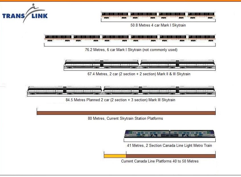
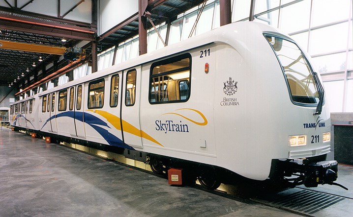
Metro Vancouver’s SkyTrain light-metro system operates two very different railways: the Canada Line which is a conventional railway, built as a light metro and the Expo and Millennium Lines which operate the proprietary and now called Movia Automatic Light Metro (MALM) system, the sixth rebranding of this obsolete mini-metro. Only seven MALM systems have been built in over 40 years, with Alstom now being the fourth owner of the proprietary railway. Previous owners were Bombardier, Lavalin and the Urban Transportation Development Corporation.
Canada Line operation is incompatible with the Expo and Millennium Lines and vice versa.
Only Vancouver continues to build with MALM.
Today, MALM is considered obsolete as it lacks capacity, costs more to operate and maintain than comparative light rail systems and lacks flexibility which is very important in the 21st century.
The $2.4 billion Canada line was the BC Liberals foray into transportation Private Public Partnership or P-3. The Canada Line a capacity-constrained heavy rail metro, built as a light-metro, costing much more to build than a modern tram, with less capacity. Internationally, the Canada line is considered a classic transit “White Elephant”.
The cost to have the Canada Line rehabbed to match the present maximum legal capacity of 15,000 persons per hour per direction (as stated in Transport Canada’s Operating Certificate) for the Expo and Millennium Lines, is now between $1.5 to $2 billion dollars.
This must be done before any extension to the Canada Line can be considered.
A big problem for TransLink is rumblings from Alstom indicate that production of MALM cars may cease when the last production orders have been filled in 2025, which also marks the end of service for the Detroit and Toronto MALM systems. No sales for the past 15 years may speed up the decision to abandon the proprietary railway, which would both drive up the cost of new vehicles as no other company makes MALM compatible cars and the cost of replacement parts.
The cost for light metro, especially MALM extensions, is rapidly increasing, quickly making such extensions not cost effective.
There may be no further extension to the MALM Lines after the completed Broadway subway to Arbutus! Talk of extending rapid transit to the North Shore is nothing more than political posturing, for photo-ops and sound bytes at election time.
“The problem with TransLink is that you can never believe what it says; TransLink never produces a report based on the same set of assumptions.”
Former West Vancouver Clr. Victor Durman, Chair of the GVRD (now METRO) Finance Committee.
DARK CLOUDS
There has been a change in scope for the Expo Line Extension Project to Langley, from 2 stages into a single stage project due to escalating costs.
The cost to go 7 km to Fleetwood was around $1.69 Billion to $1.72 Billion, exceeding the $1.63 Billion budget and why it is now combined into a single stage project. According to the second stage of Translink’s 10 year funding plan and the Rapid Transit Funding Agreement for the Surrey LRT Line, roughly $165 Million of that $1.63 Billion was coming from some past but mostly future tax and fee revenues (2018-2028 period).
Translink’s local fuel taxes, development charges, parking fees, property tax increases as well as targeted amounts of Translink’s own passenger revenues were to help fund roughly 8.6% of the $7.3 Billion Second Stage of the 10 year funding plan, roughly $627.8 Million in total. This plan included the Broadway Millennium Line Extension to Arbutus, the Surrey LRT Line and many, many other smaller capital programs.So far, the Translink funding for the Broadway extension is unaffected. However, because of the pandemic, Translink is short $78.8 Million in planned revenues from 2019 and 2020 (their figures not mine), 2021 is not done yet and it may take years for Translink revenues to return to pre-pandemic levels. So it’s not $1.63 Billion in existing rapid transit funding, it’s actually around $1.55 Billion and dropping.
A new business case and a new funding plan is needed for the Expo Line extension and it will take 2 to 3 years to redo this process: No business case, no funding plan. Translink isn’t even involved in the project management anymore, as it is now a provincially run project. Translink may not be capable of being a full financial partner in this project or any other large capital project for some time, due to its current budget issues. This is not good news for the Surrey Extension and even worse news for the North Shore.
A dark financial cloud on the horizon is beginning to appear larger. Translink had to begin serious final planning and engineering on the second stage of the Broadway Millennium Line extension from Arbutus to UBC by 2024, if construction is to begin in 2026.
They estimate this extension project to cost between $4.98 to $5.12 Billion for the planned 7.3 km long tunnel and above grade structure into UBC, that’s right now, 2021.
The actual date of final bidding and procurement will determine its actual final cost, when that is complete the final total will be known. The cost of the Broadway Millennium Line extension from Arbutus to UBC is predicted to be between $4.98 and $5.12 Billion and the cost is growing between $158 to $164 Million every year due to the current estimate of inflation. August’s inflation rate was 4.1% and recent news reports have this figure climbing higher.
This does not include inflationary costs of construction materials, which is usually considerably higher than the basic inflation rate. Structural concrete prices increases alone, could add anywhere from $36 Million to $55 Million per year on top of just the basic inflation.
The question for TransLink and the province is whether they pay $2.65 Billion for the Langley project or wait and fund $3.77 Billion for UBC extension,both will not be funded at the same time.
Unless something drastically changes soon, the current Langley Skytrain extension project in its present form is dying and may be put off, well into the next decade.
This bodes ill for any SkyTrain light metro connection to the North Shore.
RAIL FOR THE VALLEY’S SOLUTION
It is widely accepted that only a rail solution will attract the motorist from the car; buses have proven disappointing in operation, as they get stuck in traffic and true Bus Rapid Transit costs only a little less to build than LRT with none of the operating or capacity benefits. Only politicians think buses can be rapid transit, yet sadly for the transit customer, a bus is a bus, is a bus.
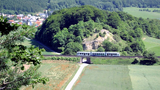
Rail for the Valley’s Leewood Study provides an affordable alternative, operating a regional passenger service using existing railways. As there is a railway connection from Vancouver to the North Shore, Squamish and beyond to Whistler, a passenger rail service must be considered.
Modern articulated rail cars can travel at higher speeds on curving track, giving realistic travel times and properly signalled with passing loops (double track), trains could operate up to three times an hour per direction.
This is not fanciful thinking, rather it’s what is currently happening in Europe where the huge cost of new metro and highway construction has forced planners to use existing railways for a regional rail service that people will use! In Europe and now even in the USA, disused railways are being refurbished and abandoned railways are being rebuilt as a much cheaper alternative than stand alone metro lines or new highways.
The modern articulated railcar, powered by clean diesel or electricity from by fuel cell or by overhead wires, can obtain commercial speeds acceptable by customers on even the most difficult routes. The modern articulated railcar can contain amenities such as a WC and or a ‘bistro’ offering light refreshments for the longer trips. The modern articulated railcar can also operate in multiple units, thus capacity can be increased when needed.
The modern articulated railcar can also increase vehicle capacity by adding additional modules at a much cheaper cost than buying a new vehicle.
Based on the Leewood Study and taking into consideration that the track is in excellent condition, the cost for the approximately 80km Vancouver to Squamish regional passenger railway, using the Canadian National Railway and the former BC Railway right-of-way, with a maximum of three trains per hour per direction would be in the neighbourhood of $1 billion.
The new regional railway would have stations at the Squamish, Britannia Beach, Lions Bay, Horseshoe Bay, Caulfield, West Bay, Ambleside, Capilano, Lonsdale, Lynn Creek, and Vancouver, Pacific Central Station.
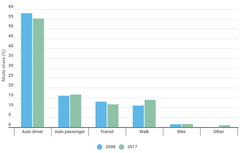
The province and region are now in a climate emergency, combined with worsening regional traffic congestion. The current transit planning based on light metro and the hub and spoke philosophy of transit (where buses bring customers to transit hubs) is failing as pre covid, regional mode share for transit is dropping. Planning and building more SkyTrain light metro lines is akin to doing the same thing over and over again ever hoping for different results.
Metro Vancouver must plan cheaper, user-friendly transit options in order to attract the motorist from the car, as the present light metro system has failed to do so and despite an over $15 billion taxpayer investment.
For less than the cost of a now $3 billion, 5.8 km Broadway subway or just over half the cost of the over $4 billion, 16 km Expo Line extension to Langley, we could build two regional railways, connecting Vancouver to Chilliwack and Vancouver to Squamish, with a possibility of a 210 km regional rail service, with through service from Squamish to Chilliwack, via Vancouver.
There are many obstacles to overcome and all levels of government must be on board but….. the time has come to stop transit planning for politically prestigious projects and plan for the region’s future and the future is an affordable and user friendly transportation network, which the present transit system is definitely not.
North Shore Connects faces a Hobson’s Choice for transit planning, either advocate for what could be affordably built or advocate for ‘pie in the sky’ rapid transit solutions that will not be built.
From Norman Farrell’s In-sights blog, commenting on the NDP’s continuation with the Site “C” dam project despite the fact that Site “C” is a risky $16↑billion energy project that will cause massive ecological damage and produce electricity at 4x the cost of alternative sources..
The same is true with the now $3 billion Broadway subway (BS Line) and the now $4 billion Expo Line extension to Langley. Bot transit projects are hugely expensive for what they can do with little or no benefit for the transit customer.
The planning fallacy stems from an overall bias towards optimism, because people are oriented towards positivity. Politicians are more likely to be biased this way than others.
In Metro Vancouver, local politicians are wonderfully ignorant of transit, transit mode and more, yet they perceive themselves to be transit experts and refuse to consider any alternative, except their own. This leads to extremely expensive, yet questionable transit developments.
We have a tendency to discount pessimistic views or data that challenge our optimistic outlook. This is the flipside of our positivity bias: our preference for affirmative information also makes us reluctant to consider the downsides.
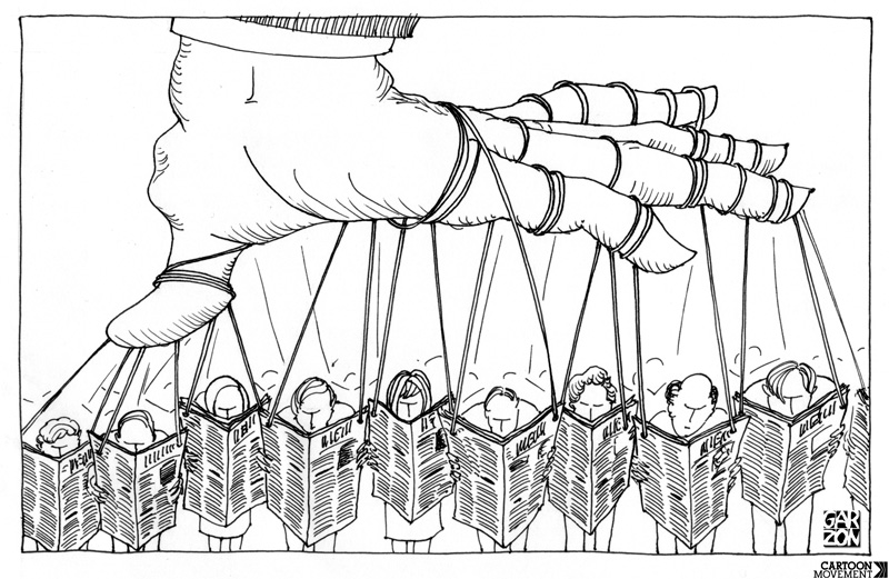
Again, in Metro Vancouver negative news about TransLink and transit is censored. The mainstream media is reluctant to report dissenting news, thus the public remain ignorant of real problems.
When organizations plan projects, too often they focus on imagined successful outcomes not potential pitfalls. They are likely to overestimate their capability of achieving project goals. The result is financial disaster, something that governments will almost never admit.
Local rapid transit projects are expressed in arcane terms like car-trips or the cost of commute time. Most of it is just invented.
Anchoring is the tendency to rely too heavily on early information when making decisions. After the initial plan for a project, managers are biased to continue thinking in terms of initial goals, methods, deadlines, budgets, etc.
This happens with our rapid transit planning, which bases the future operation of light-metro, with very dated statistics about light rail, sometimes 40 years out of date!
Anchoring is especially problematic if original plans were unrealistically optimistic. Even if expectations were massively inaccurate, people feel tethered to original plans and make insufficient adjustments, preferring to make minor tweaks rather than major changes.
The same is true with the SkyTrain light-metro, despite the fact the system is seen as obsolete internationally, it is still perceived as high-tech and world class locally.
Project planners tend to discount pessimistic views or data that challenges their optimistic outlook. Preference for affirmative information also makes organizations reluctant to consider the downsides.
In Metro Vancouver, negative news about SkyTrain is just not printed. Politicians completely ignore problems and pretend they do not exist.
Executives often remain focused on ways of doing business they are most familiar with and fail to embrace new technology or anticipate changing methods proven by others to be successful. As a result, they underestimate project risks.
Local planners are so in-bedded with the obsolete light metro, they absolutely refuse to consider cheaper and just effective transit solutions, such as light-rail.
Managers tend to ascribe positive outcomes to their talents and hard work, but attribute negative outcomes to factors beyond control. They are convinced that external factors leading to failure were unforeseeable.
Much of our transit ills have been predicted decades ago, yet today, managers claim that the problems were unforeseen.
Workplace cultures are competitive and there may be costs for individuals who voice less enthusiastic opinions about a project. Executives favour the most overly optimistic predictions over others, giving individuals an incentive to engage in inaccurate, intuition-based planning.
BC Transit and TransLink effectively fired or had removed anyone supporting light rail, thus TransLink’s planning for LRT is so dated and biased, it is not worth the paper it was printed on.
Well, the first surprise was that this news item came via the Alaska Highway News of all places.
This tells me TransLink is spinning the story to everyone it can to give the good news to!
The big problem that there is no money to fund these grand schemes and the post Covid economy may not support the level of taxation that politicians have deluded themselves that they can shake from taxpayer’s pockets.
Metro Vancouver’s rapid transit system needs to quadruple by 2050 with 300 kilometres of new routes including SkyTrain, subway, light rail, or bus rapid transit, says a TransLink report released today.
So someone please tell me, how much will that cost?
The Expo line extension to Langley is topping $250 million/km and the Broadway subway will surpass the current $500 million/km to build. The city of Vancouver claims a 12 km streetcar will cost over $1 billion, so where is the money coming from?
It also becomes evident why Kevin Quinn was hired to be TransLink’s CEO. Kevin holds a Master’s Degree in Public Policy from Johns Hopkins University. Translation, he is an over paid spin doctor with expertise manipulating facts and truths to be fed to the public.
I sent an email to he Baltimore MTA inquiring about Mr. Quinn and what I got back was less than reassuring.
You are about to get a new CEO of TransLink in the person of Kevin Quinn. this is a good news/bad news situation. Good news is we are rid of him, bad news you are getting him.
Mr Quinn may be the nicest yes man you will ever meet. he is very personable and friendly but have yet to actually see him in 6yrs have an opinion of his own and if he has any use for light rail he has kept it well hidden.
Hopefully you will have better luck than Baltimore, ridership is off (before pandemic) 2% year over year since he took over.
TransLink has serious financial problems; TransLink has not sourced the extra $1 billion dollars to complete the Expo Line expansion to Langley. TransLink does not have the funds to cover cost overruns on the Broadway subway. Covid has cut deep into ridership and ridership revenue. So what does a university trained spin doctor do, smother us with dreams of transit here, there and everywhere, while lurking in financial shadows deflecting the truth.
TransLink also has ridership problems, as transit use has been slowly dropping pre Covid as the following table records. The ridership numbers are increasing at a slower rate when compared to rising population numbers.
Let us not forget that transit ridership in Baltimore decreased 2% a year every year, during Mr. Quinn’s tenure there!
Pre Covid, Mode share for transit was declining.
What TransLink is doing is opening the first shot for the 2022 civic campaign giving current politicians platforms to win their reelections. TransLink has no money, revenue is dropping, there is a $1 billion and growing shortfall of money to complete the Expo Line expansion, costs are sure to increase for the Broadway subway, so the big transit lie is offered and…………
when you repeat a transit lie often enough, the people tend to believe it!
300 kilometres of new SkyTrain, subway, light rail, or bus rapid transit routes needed, study finds.
By: Jeremy Hainsworth
TransLink’s draft Transport 2050 strategy has 100 recommendations to improve transportation over the next three decades.translink
Metro Vancouver’s rapid transit system needs to quadruple by 2050 with 300 kilometres of new routes including SkyTrain, subway, light rail, or bus rapid transit, says a TransLink report released today.The draft Transport 2050 strategy lays out a vision for the region’s future with 100 recommendations to improve transportation over the next three decades.
“Transport 2050 will transform the way we move and live, and it’s imperative that the region’s transportation future is guided by the people who call it home,” TransLink CEO Kevin Quinn said.
And, with growth projections showing a huge influx into the region by 2050, transit expansion will be needed.
“Metro Vancouver grew from 2.38 million people in 2011 to 2.59 million people in 2016. Regional Planning’s modelling shows that this growth trend will continue. The region is anticipated to reach about 3.8 million people by 2050,” said an April Metro Vancouver Regional District report.
Other key TransLink recommendations include completing an 850-kilometre traffic-separated major bikeway network to connect communities with greener, healthier transportation options and promoting electric and shared vehicles such as bikes, scooters, and cars.
The report was released as TransLink opens its third and final round of public engagement on Transport 2050 before the strategy becomes final. TransLink wants to gauge public support the overall strategy, and is seeking suggestions for improvement.
“Based on the input, we will update the strategy before sending to the TransLink Board and Mayors’ Council for final approval in early 2022,” TransLink said in a news release.
“Transport 2050 will have wide-reaching benefits on our lifestyles in Metro Vancouver,” said Mayors’ Council chair and New Westminster mayor Jonathan Coté. “Our ability to move around has massive impacts on our quality of life, climate change, and our potential to grow as a region.”
B.C.’s Minister of State for Infrastructure Bowinn Ma said Victoria is committed to reliable, affordable, low-carbon travel options.
“This includes investing in public transit, expanding active transportation networks and facilities for people who walk, bike, and roll, and supporting the development of complete communities that allow people to live close to where they work, study, and play,” Ma said. “Transport 2050 will provide an important roadmap to guide us toward those objectives.”
Minister of Environment and Climate Change Strategy George Heyman said Lower Mainland residents expect affordable transportation options supporting climate change action.
“By aligning priorities – such as increasing the region’s use of transit and active transportation – TransLink and the province will create a bigger, better, cleaner transportation system that will serve generations to come,” Heyman said.
The final phase of engagement begins was to start Oct. 12 and run until Oct. 29. Members of the public are invited to learn more, complete a survey, or register for an online open house by visiting transport2050.ca.
The problem with REM. like the Canada line is that it is more of a financial tool than a public transit line and because of this, the transit customer has been ignored.
A healthy transit system offers multiple ways to get between points A and B — not only does this offer users choice, it helps spread people out and offers alternatives in case of service disruptions.
The Canada Line has never gone under the scrutiny that REM has, as our extremely lazy mainstream media uses rosy news releases from TransLink as actual news.
With the Canada Line, suburban transit customers lost their direct service to downtown Vancouver with the forced transfer from bus to metro at Bridgeport station and because of this the expected increase in suburban ridership never materialized.
As there are many post secondary institutions along the Canada Line, including the downtown campuses of UBC and SFU, Langara College and a many other private schools and colleges and the proliferation of the $1 a day U-Pass, the Canada Line ‘s two car trains tend to be full.
The question TransLink refuses to answer is:
What percentage of the Canada Lines customers are U-Pass holders?
In fact TransLink and the SkyTrain lobby gets touchy when one asks this and one wonders why? How many daily unique uses of the Compass Card/U-pass is there on the light metro system?
TransLink refuses to release this information and instead, continues to use boarding’s, which is hardly helpful.
The REM light metro is nothing more than a financial tool, with the carrot that the politicians do not have to take responsibility for the system, but still can use the the light metro as a backdrop for pre election photo-ops. The problem with this is what is currently happening in metro Vancouver is that the transit customer is abandoning transit for the car. Mode share for transit has dropped to 14% pre Covid and the post Covid recovery is not materializing as fast as TransLink would have wished and the near future looks somewhat bleak.
If this sort of transit planning and construction continues, bodes ill both for quality transit in Vancouver and for the fight against global warming.
What’s wrong with the REM? A feature report on Quebec’s mass transit con
“Just like the construction of the Olympic Stadium, Montrealers can do little but watch billions in public money wasted on a glamour project of dubious necessity.”
Every time there’s an announcement about the Réseau express métropolitain (REM), the pundits, politicians and PR hacks frame it like a late-night infomercial advertising some product you never knew existed but was now available to solve your and all the world’s problems. Finally, they exclaim, Montreal is getting the REM.
Ever since the government of Quebec awarded a no-bid, sole-sourced contract to the provincial pension fund (the Caisse de dépôt et placement du Québec, or CDPQ) to build a new mass transit system, I’ve been concerned this might not be the best idea. I support public transit because I believe it’s the best way to control carbon-dioxide emissions and to make cities far more liveable. Congestion, pollution and emissions all work together in depreciating our quality of life, and I often find myself wondering how we might use our public spaces differently if we only had to contend with a quarter, third or half as many cars.
That aside, the REM is behind schedule, over-budget and bits and pieces of it are being scaled back. It will open later than originally stated, have fewer stations and may not go to all the places we were told it would. Perhaps more disturbingly, both the CDPQ and the political class are now talking about extending it all over the metropolitan region, as though more of this overhyped panacea to all our transit and traffic woes will distract us from the fact that it hasn’t even gotten off the ground yet.
Much like a runaway freight train, there’s little hope of stopping the REM. Indeed, our future REM trains are supposed to be fully automated — no need for pesky unionized transit employees dipping into the profit margin — and so likely won’t have anyone aboard to hit the brakes in case of an emergency. The REM — and this cannot be forgotten — was a decision of the Quebec government in collaboration with the provincial institutional investor, the CDPQ. Neither Denis Coderre nor Valérie Plante had anything to do with it, despite what they may tell you. This was never Montreal’s decision to make, as our transit agency was never initially consulted.
The main reason why the REM won’t be stopped, no matter how many problems it produces, is because there will be incredible financial penalties to pay. Moreover, the work that’s already been done has been so expensive that no government would risk pumping the brakes to re-evaluate just what exactly it is we’re doing, or ask the question whether this is really worth it.
All we can do at this point is complete the project and try to wrestle back some control into the hands of the people who need and use public transit, rather than those who seek to profit off it.
So with all this mind, let’s consider some of the most recent developments.
Anyone who’s not too stoned to recall 2015-16 (when the REM was first announced) will doubtless remember the centrality of the airport connection. Finally — we were told so many times — Montreal would have a quick and efficient connection to the airport. Now it seems that Aeroports de Montréal is unable to come up with the estimated $600-million to build the connection. It’s a neat idea to have direct public transit connections between airports and city centres, but in Montreal’s case the passenger estimate for the new airport stop isn’t terribly impressive. One estimate prepared for the CDPQ back in 2016-2017, and based on data from 2015, put the daily average number of airport REM station boardings between 4,600 in 2021 (what was supposed to be the first year of operation) and 5,600 in 2031 (after a decade-long “ramp-up” in use). This would put the airport REM station in the same range as some of the lesser used metro stations. Some of the more optimistic pre-pandemic projections indicated 10,000 passengers will use the station per day. While it’s true the number of passengers using Trudeau airport has been steadily increasing over the years, it was still just 20 million passengers per annum, and that was before the pandemic. It may not be until the end of this decade that we get back to that level of passengers, and of course, the major reductions in flights also means major reductions in airport workers too, further sapping the number of people who may use a new REM airport station.
The airport station reveals other shortcomings of the REM. The way the system was designed, the only trains that will run directly to the airport are those leaving the McGill/Central Station nexus downtown. If your starting point is on the South Shore, in Deux Montagnes or in the West Island, you’ll have to switch trains, as none of those branches will run trains going directly to the airport.
While the estimated travel time between downtown Montreal and the airport will probably clock-in at 20-25 minutes, passengers coming from other areas can expect much longer commutes. For the majority of West Islanders, Lavalois and people living on the western side of the off-island suburbs, taking a cab or driving will unfortunately still be the most efficient way to get to the airport. And at 20-25 minutes, the REM isn’t that much more competitive on the downtown-airport run than the existing bus service.
Worse, it’s not like Montreal can take the $600-million earmarked for the airport station and use it somewhere else — like buying 600 brand-new electric buses from a local bus manufacturer (NovaBus’s fanciest, fully electric buses cost $1-million apiece). For comparison’s sake, 600 new buses, each carrying 80 passengers, just increased Montreal’s public transit capacity by 48,000 people per minute. This would be a considerable improvement over the few thousand additional passengers handled by the airport stop, but more significantly, the buses, unlike the REM, can go anywhere.
Why are we so caught up with the idea of riding the REM to the airport? It probably stems from the same minds that think a REM monorail over René-Lévesque is also a good idea. In sum, Montreal’s getting transit solutions to problems that don’t really exist, dreamt up by people who may not live here and likely haven’t used public transit in decades.
The people who are calling the shots consistently pitch the REM as a solution both to congestion as well as something that will encourage people to abandon their cars and hop on board the sustainability train. They pitch the REM as something “cool” that people will look forward to trying, and I can’t help but wonder how many of these people marvelled at the various new fangled transit technologies demoed at Expo 67, like hovercrafts (no longer will your boat be confined to water!) or gondolas (they’re not just for Switzerland anymore!).
Yes, people do need to be encouraged to take public transit, but this won’t happen if you spend several years ripping up the existing transit infrastructure. The STM’s ridership numbers were increasing steadily year over year until the Coderre administration made serious service cutbacks in 2014. Consequently, use declined, something REM construction exacerbated.
When it was originally proposed, the REM was supposed to use existing infrastructure. The public was assured that the construction of the REM would have a minimal impact on extant infrastructure. But rather than buying trains to fit extant infrastructure, the CDPQ instead decided to build everything anew, from the trains to the track to the power systems. In so doing, the most-used commuter train line in Greater Montreal was shut down, and the excessively expensive Mascouche Line was cut off from downtown Montreal, rendering it essentially useless. New double-decker trains bought less than a decade ago are no longer needed. It goes on and on like this. Just like the construction of the Olympic Stadium, Montrealers can do little but watch a white elephant get built, billions in public money wasted on glamour projects of dubious necessity.
There’s a common denominator to this mess: Montreal’s transit isn’t planned by Montreal. The REM was always a Quebec government and CDPQ project, and it’s worth pointing out that the CDPQ had no prior experience in the construction or management of mass transit systems, let alone public transit.
Montreal is actually legally prohibited from developing its own public transit systems (see item #151 here). That is to say, if Montreal had $10-billion lying around, it would still not be allowed to expand the metro.
We have no choice but to involve middlemen in our own transit planning decisions. With regards to the REM, the Quebec government handed incredible power over to the CDPQ. They were given exclusive rights to public infrastructure (like the new Champlain Bridge and the Mount Royal Tunnel) and further granted non-compete agreements with other modes and services of public transit. Looping back to the issue of the airport station, the CDPQ actually managed to get the government to agree to force the STM to cancel the 747 airport shuttle to give the REM exclusive airport access (see pp. 10-11 here).
No public transit planner would ever plan transit like this.
Once the REM becomes operational, all other transit modes and systems will be reoriented to serve it. Eliminating duplication may seem like a good idea to the number crunchers, but users and planners understand that operational redundancy is vital. A healthy transit system offers multiple ways to get between points A and B — not only does this offer users choice, it helps spread people out and offers alternatives in case of service disruptions.
What concerns me most of all about the REM — aside from the fact that we’re essentially subsidizing the CDPQ’s real-estate development plans and being used as guinea-pigs for their infrastructure development business — is that we’ve been forced to hand over control of public transit to a for-profit organization. The CDPQ included a clause stating their annual return on investment would be set at 10% irrespective of the REM’s actual revenues. If the REM doesn’t produce this return, taxpayers foot the difference.
There’s nothing really novel about the REM. It’s just another imposition on the city of Montreal by people who claim to have our best interests at heart, but are truly only interested in sucking as much money out of the public purse as they possibly can. The REM is shiny and new, and may or may not reach the airport, but it isn’t the boring old solutions that would likely have the best overall impact. There are experts, but they weren’t consulted. There were consultations, but the people were ignored. There was an environmental assessment that was highly critical of the project, and then-Premier Couillard decided it had exceeded its mandate. We were given the bare minimum opportunity to speak, but no one was really listening.
So what do we do now?
It’s an election year, there’s a good chance Coderre will run, and he’ll likely position himself as the REM king. Mayor Plante, not wanting to be upstaged, will likely match or exceed whatever Coderre’s position is on transit development. Expect a lot of talk about a Blue Line extension to Anjou (finally!), more talk about a Train de l’Est and/or some kind of Pink Line/ Train de l’Est amalgam (finally!!) and monorails over René-Lévesque (finally!!!). They’ll likely each have a position on the airport connection as well, and here Montrealers may have a chance at regaining a degree of control over public transit. We can say no, we can demand the REM be subsumed into the STM and we can insist the citizens and government of Montreal be given the control they deserve over their own transit systems.
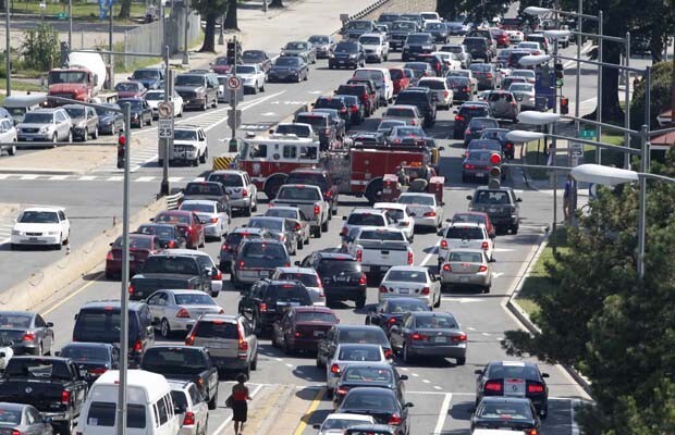
Let’s build more highways and bigger tunnels and bridges to cure congestion. Let us build 10 lane tunnels and bridges; let us build ten lane highways: let us build ourselves out of gridlock.
Sorry, facts show that one cannot build oneself out of congestion and gridlock as building bigger bridges and tunnels and wider highways does not cure congestion and the opposite happens, congestion and gridlock gets worse.
Gordon Campbell’s multi lane Port Mann bridge replacement has not cured congestion and in fact has made congestion worse, with Highway 1 gridlocked from Chilliwack to Vancouver.
The Massey Tunnel replacement is more of the same with politicians wanting bigger and wider bridges and tunnels to solve gridlock but the opposite will happen, as it has done over and over again, congestion will increase and gridlock continues.
Thus Metro Vancouver’s bridge, tunnel and highway expansion craze, costing billions of dollars, will not solve congestion, but make it worse.
Why then all those cars on the road? Why are they not using SkyTrain?
Simple answer is, SkyTrain does not go where they want to go. The transit system is wedded to an extremely dated hub and spoke, transportation philosophy where buses meet rapid transit at hubs and customers transfer and transfer again at the next hub.
Unlike much cheaper light rail (up to ten time cheaper), SkyTrain is stuck in a 1970’s bubble in a 2020’s world and customers are voting with their cars their dislike of transit.
The big problem is that regional, provincial, and federal politicians still believe that transit is a side show, a distraction and the real vote getter is bigger and bigger bridges, tunnels and highways with affordable transit options quietly ignored.
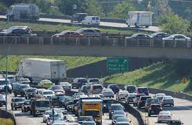
U.S. transportation authorities have spent billions widening urban freeways to fight traffic delays. What makes the “iron law of congestion” so hard to defeat?
Twelve lanes of Interstate 35 slice through the heart of the city of Austin. But that doesn’t appear to be enough: The highway is often choked with truck and commuter traffic, which is only thickening as the regional population balloons. A recent study named Austin’s section of I-35 the worst bottleneck in Texas.
The Texas Department of Transportation, known as TxDOT, says it knows what to do: Widen the freeway. The agency proposes adding eight more lanes, at a projected cost of $7.9 billion.
Many Austinites are skeptical. The plan would require destroying an estimated 150 homes and businesses and further embed an infrastructural barrier that has served as a racial dividing line since the 1940s. It would also increase vehicle emissions at a time when Austin is struggling to reach its climate goals. But TxDOT maintains that environmentally friendly alternatives to road widening, like investing in transit, are off the table. “We are allowed, right now, to be furious, to break things, to do what is needed to demand to be heard,” Austin Chronicle columnist Mike Clark-Madison recently wrote.
Beyond the damage that a bigger I-35 would do to racial and environmental equity, many city officials doubt that TxDOT’s proposal would achieve its stated goal of reducing congestion. “We know from experience, in Texas city after city, that a simple addition of lanes will not fix our traffic woes,” wrote Austin city council member Gregorio Casar, in a letter to TxDOT.
There’s a name for the principle behind that apparent paradox: induced demand. Economist Anthony Downs is often credited with first articulating this “iron law of congestion” in 1962, as construction crews were hacking interstates through American cities. Downs published a seminal paper with a stark warning: “On urban commuter expressways, peak-hour traffic congestion rises to meet maximum capacity.” In other words, adding lanes won’t cure snarled traffic; the additional car space inevitably invites more trips, until gridlock is as bad as ever.
Downs was not the first to sound an alarm about the futility of expanding urban roadways — not by a long shot. In 1932, an association representing streetcars warned that “as fast as improvements are made in existing arteries of travel … they are saturated by an increasing volume of traffic.” In 1955, urban observer Lewis Mumford wrote a series of essays in the New Yorker titled “The Roaring Traffic’s Boom,” in which he memorably compared a highway planner widening a congested highway to “the tailor’s remedy for obesity — letting out the seams of trousers and loosening the belt. [T]his does nothing to curb the greedy appetites that have caused the fat to accumulate.”
Downs’ iron law applies not only to U.S. cities, which have grown more traffic-jammed despite billions of dollars in fresh pavement, but also to those around the world. Highway expansions in Norway and Britain haven’t reduced congestion there, either. The principle now meets little opposition among economists and urban planners. “It’s widely accepted,” says John Caskey, who teaches induced demand as part of his urban economics course at Swarthmore College. “For economists interested in urban transportation, there isn’t really any debate.”
But a scan of current headlines reveals that a sizable chunk of the U.S. transportation sector still believes otherwise. South Carolina wants to spend $3 billion (and displace a minority neighborhood) to widen a freeway interchange “choked with traffic” near Charleston. In Los Angeles, Metro lists several highway expansion projects on its website under the heading “Less Traffic.” Maryland’s “Traffic Relief Plan” revolves around widening I-270 in suburban Montgomery County. The budget for Portland, Oregon’s Rose Quarter freeway expansion, which promises to both smooth the state’s biggest bottleneck and boost economic development in the predominantly Black neighborhood decimated by the original freeway’s construction, is now north of $1 billion.
If the definition of insanity is doing the same thing over and over and expecting a different result, then these transportation agencies seem certifiably nuts. Why is it taking so long — and why has it been so hard — for officials to recognize the futility of urban roadway expansion?
Highway planners aren’t crazy. But they are operating within a political and financial system that rewards new construction, despite its consistent failures to reduce congestion. A stroll through transportation history suggests that, unless those underlying incentives change, we’re likely doomed to continue repeating the same predictable, costly mistakes.
For over 12 years, Rail for the Valley has been advocating the reinstatement of the Vancouver to Chilliwack interurban service and in doing so, are being advised by professionals and engineers who have a sound knowledge of public transit systems and transportation modes.
The following are pertinent facts being overlooked by local, provincial and federal politicians.
Prior to the 2018 civic elections, the current mayor of Surrey claimed he was an expert and that the SkyTrain could be built to Langley for $1.65 billion.
The current estimated cost for the 16 kilometre Expo Line extension to Langley is in excess of $4 billion.
The name of the actual proprietary railway used on the Expo line is the Movia Automatic Light Metro (MALM)
MALM is the sixth rebranding of the proprietary railway and is now owned by Alstom after it purchased Bombardier’s rail division. Previous brands were Innovia Light Metro; Advanced Rapid Transit; Automatic Light Metro; Advanced Light Rail Transit; Intermediate Capacity Transit System.
Due to the flip flop from LRT to MALM, a new business case must be presented and a two year bidding process must be restarted from scratch.
The Expo Line extension to Langley is now underfunded by over $1 billion.
There has been no planning for building a cement viaduct over the Serpentine Valley and this will greatly increase the cost of the project.
The cost of cement and specialty steel needed for light metro construction is rising 2 to 3 times that of the rate of inflation. Inflation is projected to be 2.2 per cent in Canada in 2022.
To operate more trains on the Expo and Millennium Lines, a $3 billion rehab must be done to: replace and increase the electrical supply; replace the Citiflow automatic train control system as Bombardier Inc. is no longer supporting it; all switches must be replaced to permit faster running to increase headways, needed to increase capacity; all stations must be refitted to permit higher customer flows (is being done piecemeal).
As Vancouver is now the only customer for MALM and as Alstom will complete outstanding (paid for orders) by 2025, they may cease production altogether. This also coincides with the closure of two (Detroit & Toronto’s SRT) of the seven systems built around the world.
Two of the now called MALM systems in Yongin, Korea and Kuala Lumpor in Malaysia have involved both Bombardier Inc. and SNC Lavalin in court battles involving misinformation and corruption.
The cost for a 130 km, Vancouver to Chilliwack passenger service connecting Vancouver to North Delta, Cloverdale, Langley, Abbotsford, Vedder/Sardis and Chilliwack, with a maximum of three trains per hour per direction is $1.221 billion.
Rail for the Valley
Delta Optimist
Letter: Better transit for Delta?
Public transit in Metro Vancouver is designed to meet political agendas and not customer needs
Editor:
“Delta, TFN need improved transit service levels, says Harvie,” reads the headline in a recent Optimist story, but Mayor Harvie is dreaming because Delta’s transit situation will not change for a long time.
Here are two reasons why:
What was going to be a $1.65 billion extension of the Expo Line to Langley, as promised by the current Mayor of Surrey, has now turned into a $4 billion plus boondoggle, with a financial shortfall of over $1 billion!
Inflation will cause more impressive cost overruns on the Expo Line extension to Langley and the now $3 billion Broadway Subway.
The Expo and Millennium Lines desperately needs a $3 billion rehab, largely unfunded, but needed to operate more trains.
Secondly, to attract customers, transit needs to be user-friendly and the product TransLink offers is definitely not. COVID has shown that those who switched from transit to the car are reluctant to switch back, because the transit option seems third rate.
Public transit in Metro Vancouver is designed to meet political agendas and not customer needs, thus continues to grow in unpopularity, with TransLink remaining in high odour with the taxpayer.
$10 billion is needed from all levels of government (one taxpayer) to complete two light metro extensions (not to mention the $70 million to $80 million increase in annual operating costs) that will do little or nothing relieving congestion and pollution.
SkyTrain light-metro is notorious for not attracting the motorist from the car and why the proprietary railway has failed miserably internationally, with a total of seven such systems sold in the past 41 years and only five remaining after 2025.
SkyTrain’s current financial obligations means transit customers will be waiting a long time for local bus improvements, as Vancouver, Surrey and Langley are getting politically prestigious, platinum-plated rapid-transit at the expense of everyone else!
Rail for the Valley
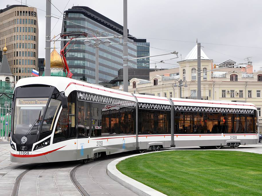
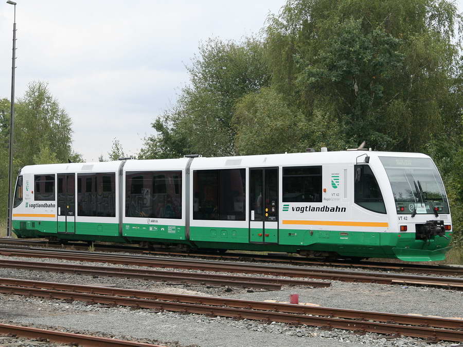
TramTrain as used in Zwikau, Germany.
Chilliwack Progress
LETTER: SkyTrain announcement condemns Fraser Valley to more congestion
$1.5-billion investment could create communities with a modern 130-kilometre regional railway
Jul. 16, 2021
Friday’s federal funding photo-op for the $3.95 billion, 18-kilometre Expo Line extension to Langley, didn’t mention that the project is almost $1 billion short of funding and the shortfall must be made up by the province and TransLink, with higher user fees, transit fares, gas taxes and many more hidden taxes that subsidize the present SkyTrain light metro system.
That does not make for good photo-ops. If Justin Trudeau and John Horgan really want to reduce pollution and congestion, SkyTrain light-metro is the wrong way to go, because it doesn’t. It has been recognized for decades that light-metro is very poor in reducing congestion and associated pollution, as Vancouver has demonstrated.
Secondly, to attract customers, transit needs to be user-friendly and the product TransLink offers is definitely not. COVID has shown that those who switched from transit to the car are reluctant to switch back, because the transit option seems third rate.
Public transit in Metro Vancouver is designed to meet political agendas and not customer needs, thus continues to grow in unpopularity, with TransLink remaining in high odour with the taxpayer.
$10 billion is needed from all levels of government (one taxpayer) to complete two light metro extensions (not to mention the $70 million to $80 million increase in annual operating costs) that will do little or nothing relieving congestion and pollution.
SkyTrain light-metro is notorious for not attracting the motorist from the car and why the proprietary railway has failed miserably internationally, with a total of seven such systems sold in the past 41 years and only five remaining after 2025.
SkyTrain’s current financial obligations means transit customers will be waiting a long time for local bus improvements, as Vancouver, Surrey and Langley are getting politically prestigious, platinum-plated rapid-transit at the expense of everyone else!
City manager Steve Kanellakos said Rideau Transit Group reported on the root cause of the derailment: a gearbox came loose and dragged along the tracks. Kanellakos said RTG learned the gearbox bolts weren’t torqued properly.
What was going to be a showcase LRT has turned into a Light Metro fiasco.
When politicians get involved with a transit project, especially a rail projects, things get derailed quite easily.
Some historical context:
In September 2009, the City of Ottawa paid Siemens Canada Limited, PCL Constructors Canada Inc., Ottawa LRT Corp. and St. Lawrence Cement Inc. the sum of $36,718,500.00 in order to settle their lawsuit for the wrongful termination of a contract for the design, construction and maintenance of a light rail transit system in Ottawa.
The project consisted of 27 kms of electrified track, 21 specially designed and built vehicles, associated mechanical and electrical equipment and various buildings. Construction was to begin on October 15, 2006. The project was a public-private partnership between the Province of Ontario and the Government of Canada each agreeing to contribute $200 million in funding.
In October 2006, the Government of Canada announced that its funding contribution was conditional upon receiving a notice of support for the project from the newly elected City Council following the November 2006 municipal election. Following the municipal election, the newly elected council voted to change the scope of the project. The Federal and Provincial governments would not guarantee funding for the changed scope. In response, Ottawa terminated the contract on the basis that the condition precedent of funding from Provincial and Federal government had not been satisfied. The Project Agreement had limitation of liability clauses which purported to cap the plaintiff’s recovery at $2 million.
In June 2007, the plaintiffs commenced an action in Superior Court in Brampton, alleging fundamental breach and breach of the obligation to perform the Project Agreement in good faith. Brampton is the jurisdiction in which the lead plaintiffs were headquartered. In September 2008, the City of Ottawa’s motion for a change of venue from Brampton to Ottawa was dismissed. In September 2009 a settlement of the action was reached on the basis of a payment of $36, 718,500.00. Siemens Canada Limited, PCL Constructors and the Ottawa LRT Corp. were represented by McCarthy Tétrault LLP, Dean Novak, Siemens Canada Limited’s Assistant General Counsel, and Douglas Stollery, Q.C. General Counsel of PCL Constructors.
That’s right, Siemens was going to build a 27 km LRT system for $1 billion and a change of government, changed it to a $2.1 billion 12.5 km light metro.
So, the politicians in Ottawa built a light metro instead, but by using modern trams, they could call it LRT.
Sounds very familiar doesn’t it. Well it should because after the 2018 civic elections, the new Surrey mayor rejected a $1.63 billion LRT to Newton and Langley, for a now over $4 billion, 16km light-metro extension to Langley instead!
The following is a long read and Zwei will comment where deemed necessary.
Why the bumpy, two-year ride of Ottawa’s multi billion-dollar LRT system is sparking calls for a public inquiry
By Tom SpearsSpecial to the Star
Sun., Sept. 26, 2021
On an October morning in 2019, Ottawa’s shiny, new, red and white trains started full service.
And as the city held its breath, its long-awaited $2.2-billion Light Rail Transit system ran smoothly.
It was a Monday when people actually seemed to enjoy going to work. They streamed off buses onto platforms, waved along by volunteer “ambassadors” in red vests. They watched the overhead displays showing how long it would be until the next arrival, as the trains, comprised of two cars that hold nearly 300 people each, slid into their stations with a quiet electric hum.
Passengers talked happily to reporters. And the trains ran flawlessly all day east and west from downtown Ottawa on 12.5 kilometres of new track.
Commuter Kari Glynes Elliott recalls watching the first train with friends.
“We looked at each other and said: This is a game-changer. This is amazing,” Elliott says.
“We were wrong.”
The next day, the new system broke down for a while. And the next day, it happened again. And the next, yet again.
Zwei replies: We forget that the Expo Line had reliability problems for the first year of operation, with new wheels wearing out so fast that new wheel-sets were being air shipped to Vancouver.
It faltered repeatedly in the weeks that followed, as long lines of public servants got off buses whose routes now stopped before reaching downtown and walked the final two kilometres to Parliament Hill (or farther for stranded University of Ottawa students). Luckily the weather was nice, but that would soon change to a winter of discontent.
Breakdowns were a common occurrence in the LRT’s first year of operation, then things seemed to settle down. Until recently, that is. Two derailments in six weeks have sparked concerns once more about the system’s reliability.
And as the LRT’s anniversary approaches, no one is baking any birthday cakes.
The $2.2-billion LRT built so far is, in fact, just Phase 1. The trigovernment project is set to stretch into the suburbs, with Ontario and the federal government each pledging more than a $1 billion toward the next phase, on top of $600 million each for the first. But with critics pointing to the problems experienced, from quick timelines, to maintenance issues, to a lack of local experts on staff, the system that had once promised to transform commuting in the nation’s capital has become, in the view of those critics, a cautionary tale, and a legacy project for the city’s mayor has turned into a bumpier ride than anyone expected.
The past week began with a derailment and an emergency meeting of the transit commission, where a downtown city councillor, Catherine McKenney, called for a public inquiry into the LRT’s full history.
The train last Sunday derailed as it approached Tremblay station, near the city’s VIA Rail station, but its sensors didn’t notice. The train departed the station with 12 passengers and traveled a few hundred metres “in a derailed condition,” according to investigators. It crossed a bridge over a six-lane street before banging into a pole and stopping, with one car jackknifed. Track and controls were damaged all the way along, and the entire LRT has been shut down for an estimated three weeks.
The derailment on a bridge “could have been catastrophic,” tweeted Shawn Menard, another Councillor, who is backing the call for an inquiry.
Zwei replies: Actually no, as rail ridge are so designed to prevent this sort of accident with guard rails, articulated vehicles tend to to go straight.
Ridership has been about a quarter of the norm during the pandemic and its work-from-home conditions, but a return to old-style commuting with full trains may raise pressure on the system.
This light rail system has been Mayor Jim Watson’s baby, with the mayor personally rallying support for years as the project took shape.
Zwei has always maintained that the Ottawa LRT is in fact a light-metro as it operates on a totally segregated R-o-W and the trains run automatically from a central computer.
The train that derailed last Sunday was the very same train that hosted Watson and the city’s media for an opening ride in 2019. On that occasion, photographers were everywhere. But when it derailed, a transit official threatened to call police to keep photographers from shooting the scene.
Watson maintains the rail system’s challenges can be dealt with. He has also acknowledged the problems, and proposed giving residents a free transit pass for one month for the inconvenience they’ve experienced.
And he told council this week: “I don’t support never-ending meetings, which quite frankly may be good political theatre. … Our staff need to spend their scarce time resources on fixing the problem.”
Key to the rolling story of Ottawa’s LRT is that it never seems to be the same problem for long.
It’s been a laundry list of glitches, big and smell. Er, small.
Zwei replies: The big problem was that there was no commissioning time for the new light-metro, no proper run-in of equipment.
Early on it was “door faults.” If a passenger held a door open, it would refuse to close again, and the train would remain stopped until somebody overrode the sensor. This kept stalling service until passengers learned and OC Transpo adjusted the sensors to be less skittish.
Zwei replies: This has been an early and ongoing complaint of Vancouver’s SkyTrain light-metro and there is always door problems in freezing weather or snow.
Sometimes an onboard computer won’t talk to the systemwide computer, and the train stops.
Zwei replies: This is extremely common with Vancouver’s SkyTrain light-metro.
Switches that direct trains to the right track were designed with heaters for Ottawa winters, but the heaters weren’t powerful enough, so the switches froze. This happened during winter testing before LRT opened for service, but it kept happening a year later, with passengers on board. Workers with blowtorches had to melt the ice. (There are stronger heaters now.)
Zwei replies: This is an engineering fault and not a LRT fault.
Wheels developed flat spots — something that’s normal over many years but not typically in the first year of service.
Zwei replies: Wheels and track have always been a problem on Vancouver’s SkyTrain, the corrugations on the railhead need constant grinding.
Last December came more bad news: cracked wheel hubs. Alstom SA, the train’s French manufacturer, has been supplying new wheels to all the cars.
And then there’s that smell.
A strong sewage odour in the underground Parliament and Rideau stations downtown, of unknown source. Passengers with more sensitive palates say the stations smell slightly different, but both are foul.
Zwei replies: This is again, an engineering/contractor problem and not a light rail problem.
Finally came derailments in August and September, with no injuries.
In the first, technicians found that an assembly connecting an axle to a wheel wasn’t tight, and the resulting movement caused wear and eventually failure. Checks revealed nine train cars — about a quarter of the fleet — had similar problems and needed repairs.
The cause of the latest derailment is still unknown.
Zwei replies: One should wait for the official investigation to be complete before condemning the the system or vehicle.
Transportation Safety Board investigators are now looking into the wheel cracks and two derailments.
The early days when the city got on well with the private construction consortium Rideau Transit Group appear to be over.
The city has periodically withheld its monthly maintenance fee of more than $4 million. The Rideau Transit Maintenance consortium has a 30-year contract to keep the system running.
The consortium rarely makes public statements, but did issue a news release following the recent derailment.
“We understand how much the people of Ottawa rely on the Confederation Line and we recognize and regret the inconvenience caused by this week’s closure,” it read. “Our team worked tirelessly this week to restore service this morning. Our first commitment is to the safety of our riders, staff and community.”
Frustrations from riders and advocates, however, remain.
“I’m just all sorts of angry,” said Sarah Wright-Gilbert, a transit commissioner who has emerged as the most public critic of LRT operations. (She’s not a city Councillor, but rather one of four ordinary citizens chosen by the city from among applicants for a four-year term.)
Zwei replies: This is unheard of in Metro Vancouver a common citizen chosen for being a transit commissioner.
She says that in her opinion Ottawa bought unproven trains.
“People are like: Aren’t these trains running in Russia and Paris?” she said.
Not quite. Alstom has had success with its Citadis light train in Europe and Asia. But Ottawa is the first buyer of a new model, the Citadis Spirit, redesigned for cold weather.
“It’s apples and oranges. You cannot compare them,” Wright-Gilbert said.
The Citadis Spirit has been chosen for the Greater Toronto Area’s new Finch West and Hurontario LRT lines.
“When the train is not working properly and there are so many delays … it’s not even reliable,” she said.
But there can be trouble even when the trains run on time. To make way for trains, Ottawa carved away many bus routes. People who used to take one long bus ride from the suburbs to downtown now take a bus, then a train, and sometimes a bus again to continue west of downtown.
Zwei replies: This is also true in Vancouver where major bus routes feed into the SkyTrain light metro system, with over 80% of SkyTrain’s ridership first taking the bus.
Commuter Glynes Elliott, who had great hopes on Day 1, has one son at college and one in high school. The college student has one class online followed by one in person, and sometimes the bus can get him to class on time, but not always, “which is absurd because it’s not a great distance. This is a small city. We could be able to get around with the snap of a finger,” she said.
Her younger son has a three-part commute. A bus, then two stops by train, and another bus. (He prefers to cycle instead.)
Zwei replies: This is the same complaint in metro Vancouver, where transit customers are tired of transferring and either return to the car or find other means to travel.
“This is the design of the Ottawa system now. Even for very short distances you often, if you are anywhere near the train, are sort of forced onto the train,” she said.
This week, when Coun. McKenney, at the emergency transit meeting, called for a public inquiry into the LRT troubles, the call was met with support from colleagues.
“We’re bleeding riders,” said another Councillor, Diane Deans. “People are just deciding that the transit system in Ottawa is not cutting it and they need to make alternative arrangements. It’s going to be a long time getting faith back in that system.”
“I think we bought a lemon.”
Zwei replies: I hardly say a lemon with over 600 light rail/tram operations around the world. If the Citadis Spirit trams are found to be problematic, there are many companies who can supply replacements. With SkyTrain, there is only one supplier, Alstom.
Anything can be fixed, Deans says, but OC Transpo needs to develop a strong base of rail experts rather than flying in experts from other places at crisis times.
“No one goes out and intentionally buys a lemon of anything,” a visibly frustrated Watson told reporters this week after Deans tweeted out a picture of a lemon.
He said the trains had run reliably for the past year and a half, until the derailments.
“The fact is, the system, fundamentally, is a very good system and Phase 2 will make it an even better system,” he said.
But he said Transpo must return to being reliable.
“We can’t sort of go for a few months and then have another problem and then go for a few months. That will erode the public’s confidence deeply in the system. And we have to regain their confidence because by and large we’ve lost it” through mechanical breakdowns.
He called this summer’s incidents “totally unacceptable.”
“I still have confidence that it was the right decision (to build this LRT). As you know, it was voted on unanimously. It’s always easy to second-guess, but I think it’s the right system, the right route,” he said.
Critics of the LRT say it’s hard to get information about it. Ken Rubin, a private researcher and access-to-information expert, has launched many requests about construction and operation only to see most of them stall. The problem: the private companies, RTG and Alstom, often object that the information is their confidential property. It’s “very difficult” to get information, he said. “Sometimes it takes years and sometimes it takes court decisions.”
Zwei replies: This is true of TransLink, where F.O.I’s about SkyTrain are returned heavily redacted due to it being proprietary or confidential information.
At an emergency transit commission meeting Monday, Transpo’s general manager John Manconi, who retires at the end of this month, said Alstom needs to “send an army of people in. Enough is enough. Fix the vehicle and get it consistently reliable.”
Wright-Gilbert says the view of most city Councillors “is that nothing is unfixable.”
“My response,” she counters “is public confidence is unfixable if you get to a certain point.”
Zwei replies: The public soon forget.
Tom Spears is a veteran journalist who has extensively covered the LRT in Ottawa.
Jjust a few days after Justin Trudeau’s $600 million cabinet shuffle, SNC Lavalin raised it’s dirty head out of the swamp, like a monster that refuses to die.
SNC Lavalin is one of the biggest movers and shakers with Metro Vancouver transit projects and many former employees working for TransLink, civic government and at the Ministry of Transportation.
It is safe to say, SNC lavalin has tremendous influence in Metro Vancouver and BC.
SNC Lavalin is the lead company of the P-3 consortium that operates the Canada Line and in the final bidding,SNC Lavalin bid against SNC Lavalin! for the P-3 and to no one surprise, SNC Lavalin won!
The judge, overseeing the Susan Heyes lawsuit (She won but the judgment was overturned on appeal) against TransLink called the bidding process for the P-3 a “charade”!
The mainstream media, compliant as always, never raised an eyebrow.
Maybe the RCMP should take a look?
2 former SNC-Lavalin execs arrested, charged with fraud and forgery
Charges relate to bribes that RCMP allege were paid in exchange for obtaining contracts
CBC News ·
Two former executives at SNC-Lavalin have been charged with fraud and forgery by the RCMP as part of an ongoing criminal investigation into the Montreal-based engineering company.
Known as Project Agrafe, the investigation into various SNC subsidiaries and employees is related to bribes that RCMP allege were paid in exchange for obtaining contracts.
On September 23, the RCMP arrested Normand Morin, a former vice-president of SNC-Lavalin, and Kamal Francis, a former vice-president at SNC-Lavalin International Inc.
The men were arrested in the Montreal area, where they both live. They, along with their former companies, have been charged under the Criminal Code of Canada with the following offences:
Forgery.
Conspiracy to commit forgery.
Fraud.
Conspiracy to commit fraud.
Fraud against the government.
Conspiracy to commit fraud against the government.
“We remain committed to disrupting, deterring and preventing both domestic and foreign corruption, and aim to bring individuals and companies involved in these types of crimes to justice, regardless of when they were committed,” Inspector Denis Beaudoin of the National Division RCMP Sensitive and International Investigations section said in a release.
Both men were released from custody and are scheduled to appear in a Montreal court on Sept. 27, along with representatives for SNC-Lavalin Inc. and SNC-Lavalin International Inc.
None of the charges against the men or the companies has been proven or tested in court.
It is also coming to light that both the Broadway subway and the Expo Line extension will increase house and accommodation prices, who would have thought!
“Our biggest transit investments have inadvertently displaced affordable rental with market condos,”
Good old Zwei has been telling people the same thing for almost 10 years and it is no coincidence that the term “demoviction” was coined in Vancouver.
SkyTrain is being built strictly for land use or in laymen terms, SkyTrain construction is the driver for land assembly, land speculation, the demolition of affordable housing and enriching land developers who get the same land up-zoned to higher densities to build unaffordable high rise condos for the monied set, especially overseas.
Building SkyTrain has nothing to do about good public transportation.
Election 2021: Liberal campaign promises may not achieve housing, transportation goals of British Colombians
The Liberals have promised to address housing affordability with first-time home buyer tax credits and savings accounts
Lisa Cordasco
Publishing date: Sep 22, 2021
Federal promises to increase affordable housing and expand rapid transit in the Lower Mainland could result in a higher cost of living, less-affordable housing and more climate destruction, according to some analysts and advocates.
During the recent election campaign, the Liberals made promises to address housing affordability with first-time homebuyer tax credits and savings accounts. They made other pre-election commitments to contribute up to $1.3 billion toward the construction of the Surrey-Langley SkyTrain expansion.
But housing and climate experts say neither set of initiatives will achieve its goals without integration.
“Our biggest transit investments have inadvertently displaced affordable rental with market condos,” said Alex Boston, executive director of Renewable Cities, a policy and planning think-tank at Simon Fraser University’s Morris J. Wosk Centre for Dialogue. “The Surrey-Langley SkyTrain project will actually increase carbon and congestion because it is facilitating urban sprawl.”
Jill Atkey of the B.C. Non-Profit Housing Association agrees.
“We have dislocated policies. Transportation planning is separate from housing planning and housing planning is separate from school planning, even with health care, we’re building a giant hospital at St. Paul’s with no new housing planned, around it,” she said.
Both Atkey and Boston believe a new approach is needed where groups like TransLink work with municipalities, developers and the province to create housing alongside transit corridors, and for the federal government to demand such links before providing funding.
Atkey said she is disappointed that the election promises made by the Liberals have focused more on new-home ownership.
“We were hoping to see increased investment in affordable housing, but we didn’t see much of that in the Liberal platform. There was more of an emphasis on new-home ownership, which a lot of economists say is not a good idea because it simply stokes the demand for unaffordable housing,” said Atkey. “Even with those incentives for first-time homebuyers, unless you have an inheritance, you don’t have much chance of getting into the market, so what about the rest of us?”
Boston said first-time homeowners are being pushed to the suburbs, where their costs for transportation will increase. He said vehicle growth is 2 1/2 times the rate of housing growth.
“The further you are from employment hubs and services, the more you drive. Housing developments in places like Surrey, Langley and the Tri-Cities, for example, are being created to accommodate cars. They are not transit-oriented and they are not walkable. Instead, they need to create neighbourhoods around transportation corridors.”
Boston suggests TransLink partner with developers or non-profits to build affordable housing on transit-owned property, where SkyTrain stations and transit hubs are built, and he adds the federal and provincial governments must make that a requirement to receive transit funding.
“Single-family housing developments never pay for the cost of the infrastructure they need,” said Boston. “Densely populated neighbourhoods actually subsidize those costs.”
Atkey said the Liberals did make some election promises aimed at affordable rental housing but they’re not new initiatives. Most are enhancements to the continuing National Housing Strategy.
“They plan to double the existing Co-Investment Fund, but that is not a fund that has taken off here in British Columbia. We’d rather see a complete retooling of that program,” she said.
The Co-Investment Fund offers loans to underwrite housing developments, but Atkey said the requirements cut out most non-profit and co-op housing proposals.
“You need to get municipal approval processes before getting the federal funding committed, but municipalities want funding commitments before they will entertain approval processes, so it’s a catch-22,” said Atkey. “To get though the approvals process, a non-profit would have to put up close to $500,000 and that is a huge risk to take without the certainty of that final approval.”
Atkey says groups like hers will be watching with interest a new federal promise to examine the tax regime for large corporate owners of residential properties.
“For every unit of affordable housing we are building, we are losing two affordable housing units, so the solution is not just to build, but to preserve what we already have,” she said. “We don’t have a lot of details on this yet, but this could limit the excessive profits that result from rennovictions. We’d like to see assistance for non-profits to take over these properties. The provincial government is interested, but we haven’t heard much from the federal government.”
Atkey is also interested in a federal promise of a rent-to-own program, which the province already has.
Analysts like Boston and advocates like Atkey agree more integration is needed between programs that target health, transportation and housing plans along with more co-operation among governments to align their programs and funding priorities.
“The disconnect is we have strong provincial housing programs rolling out right now and they don’t really align with the federal programs,” concluded Atkey.
Boston said there are signs that various levels of government are understanding that integration is crucial: “There is big support provincially for strengthening sustainable land use and transportation policies. The UBCM has identified it as a priority, Infrastructure Canada is internally recognizing these linkages and that’s hopeful.”


/https://www.thestar.com/content/dam/thestar/news/canada/2021/09/26/why-the-bumpy-two-year-ride-of-ottawas-multibillion-dollar-lrt-system-is-sparking-calls-for-a-public-inquiry/_main_na_fea_ott_lrt_5_.jpg)
/https://www.thestar.com/content/dam/thestar/news/canada/2021/09/26/why-the-bumpy-two-year-ride-of-ottawas-multibillion-dollar-lrt-system-is-sparking-calls-for-a-public-inquiry/na_fea_ott_lrt_2_.jpg)
/https://www.thestar.com/content/dam/thestar/news/canada/2021/09/26/why-the-bumpy-two-year-ride-of-ottawas-multibillion-dollar-lrt-system-is-sparking-calls-for-a-public-inquiry/na_fea_ott_lrt_7_.jpg)
/https://www.thestar.com/content/dam/thestar/news/canada/2021/09/26/why-the-bumpy-two-year-ride-of-ottawas-multibillion-dollar-lrt-system-is-sparking-calls-for-a-public-inquiry/na_fea_ott_lrt_4_.jpg)


Recent Comments